|
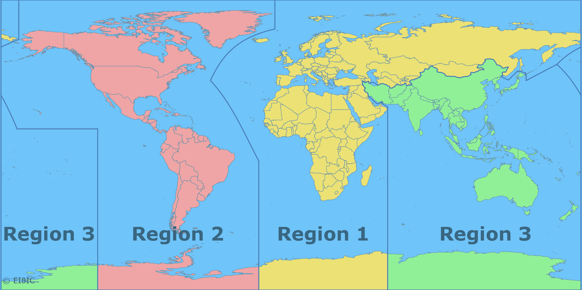
Here are two new IARU Region maps. They show International Amateur Radio Union Regions over a background of Ham Countries. You are welcome to use them on your own NON-COMMERCIAL website, if you include a link to this site, and DO NOT edit them in any way. Please Contact Me for other uses, sizes, styles, formats, or projections.

Click the map to see the full sized-version in a new browser-window.

Click the map to see the full sized-version in a new browser-window.
If you use my maps, please buy me a coffee.
How much did you spend on your rigs and antennas? Buying me a coffee isn't much in comparison, is it?!
Some Background to the IARU Region Maps:
The definitions for the IARU Regions can be found in the ITU 'Radio Regulations' manual of articles, edition of 2020, RR-2020-00013-Vol.I-EA5.pdf sections 5.2 to 5.9. The region border defintions are a little unusual in that some of the lines are specified as Great Circle arcs between points, rather than straight lines. I can only assume that they were initially demarcated by someone who was using a globe. This makes them rather difficult to draw on a non-projected map, such as the above, without suitable software.
I noted one possible error in the definitions: the line that extends along the 60 degree East meridian puts Mauritius (3B8) at 57.59E,20.28S and Rodriguez Island (3B9) at 63.42E,19.71S in different regions, which may not be the original intention. I would suggest that the line should be moved to 65E. I have mentioned this to the IARU Secretary.
|