Here are some screenshots of EI8IC's 'Great Circle Mapper' in action. Click any image to show it full sized in a new browser-tab, or download a trial to see the program on your own computer.

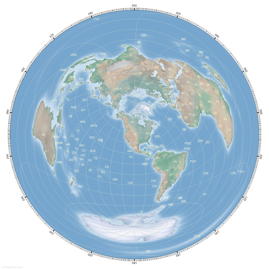
The Great Circle Mapper without its controls, showing a Great Circle Map with Amateur Radio Prefixes, centered on the USA. The map includes Latitude/Longitude lines and a Compass Rose, both set to 20 degrees. You can click the map at any point to re-center it, and export it in a variety of formats for printing or use online. |

The control panel on the left has been turned on to show its nine tab-pages that control all program functions. Here is the 'Country' tab-page, where you can select an Amateur Radio Country (aka DXCC Country or ADIF Entity) and see a variety of information about it. The entity's flag is shown too. A line is plotted from the map center to the selected Country: 'Chile', and we have the 'Beam' facility turned on too, which draws a specified antenna beamwidth over the map, showing the expected coverage for its width: 30 degrees. |

The map has been zoomed in a little, to see a view of Asia, centered on the Kyrgyz Republic, using background #19. We have the Grid Locators showing, and the Amateur Radio Prefixes. Prefix labels don't overlap, so the more that you zoom in, the more labels you will see. |

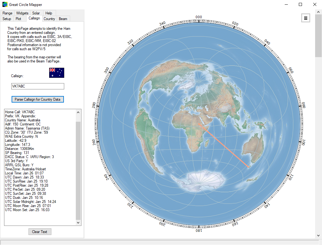
The 'Callsign' tab-page identifies a country from an entered callsign. A variety of useful information about the country is shown, including a range of detailed Solar Data. This is very useful for Low-Band DX operating and Gray-Line propagation-predictions. |

When the main controls are hidden, you can still parse callsigns. An extra click of a button shows a Callsign Parse-Box in the lower left corner. Looking up the callsign ZS8ABC identifies it as from the entity 'Prince Edward and Marion Islands' in the selector below. A flag is added, and a bearing line is drawn. If you already know the country of interest, you can also choose it in the selector. We have some of the Map Widgets showing. These are information boxes that can be dragged to any position on the Desktop. There are six different Map Widgets:
- Callsign - shows the User's callsign and Home Position
- UTC Clock - shows the current UTC time and date
- Clock2 - shows the time and date from a selected timezone
- Clock3 - shows the time and date from a selected timezone
- Solar Data - shows the latest Solar Data from the www.hamqsl.com servers
- DX Cluster - shows the latest DX Cluster spots from the www.hamqth.com servers
|

Another view with Map Widgets: this time showing the map set to the Orthographic projection (aka The World from Space). Clock2 and Clock3 can be set to any world time-zone by right-clicking the map at the desired point. The Solar Data widget updates every hour. |

Here we see the map with the Gray-Line turned on - this shows which parts of the world are in darkness and which parts are in daylight, for a specified date and time. We also have the Sun-icon turned on. The color and transparency of the Gray-Line are saved for each Background-Map. |

Here we see the map set to Orthographic projection, with the Gray-Line, Sun-icon, Sun-Track, and Sun-Analemma turned on. The Sun Track shows the path that the Sun will take over the next 24 hours, for the selected date. The Sun Analemma shows the path that the Sun will take over the next 365 days, for the selected time. |

This map is in the 'Lambert Azimuthal Equal Area - North' projection, centered on the North Pole. It can be rotated by any Longitude-value. We are plotting Country Names, and as before, the same routines show only the labels that do not overlap, and are appropriate for the map size and zoom-level. As you move your mouse across a Country Label, additional information will show: Standard Prefix, Continent, CQ and ITU Zones for that DXCC entity. |

When the map is not centered on the Home location, mouse-position data sent to the StatusBar references both Home and Map-Center positions. Holding the cursor over a Prefix-Label shows the Country Name, Continent, CQ and ITU Zones in an adjacent box. |

The 'Plot' tab-page gives access to a number of items to plot as points: Prefixes, Capital Cities, Country Names, and Beacons. Here we have selected the latter, which shows NCDXF Beacons on the map, colored to indicate the one that is currently transmitting. The 'Beacon Band' panel in the lower-right selects the band of interest. |

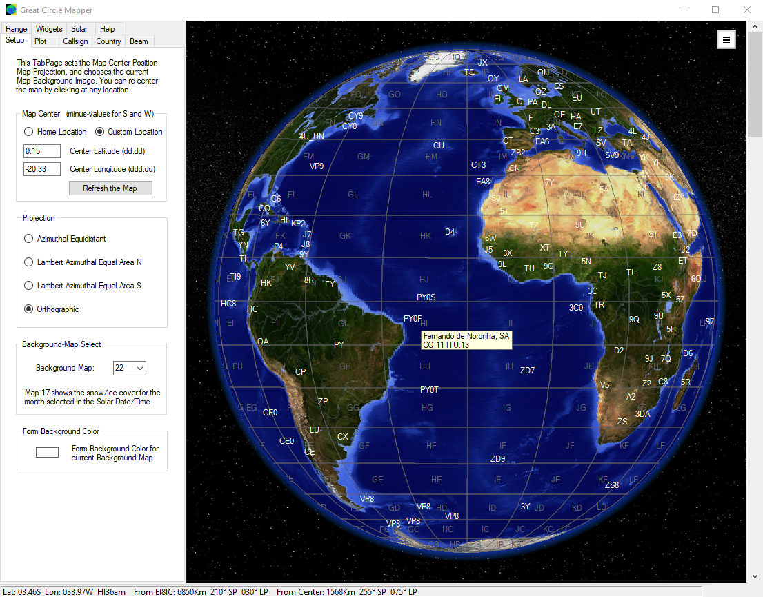
The 'Setup' tab-page is used to select the map's center-point and projection. Here we see the Orthographic 'Earth from Space' projection for background map #22, against a star-field. Prefixes have been added, and the box shows the additional information when over the prefix 'PY0F'. |

Another view of the Orthographic 'Earth from Space' projection, for background map #1. On this bigger map we have space to see all six of the Map Widgets, though they can be positioned anywhere on the Desktop, not just within the program-window. |

Here we see the 'Range' tab-page, where we can select either single or Multiple Range Rings. The ring-color, and the range-text color and font can be changed and stored for each of the 23 different background maps. |

A larger azimuthal-equidistant map (aka Great Circle), centered on the USA. Multiple Range-Rings are turned on, spaced every 3000 kilometers. You can select the distance-units that you prefer, from kilometers, statute miles, and nautical miles. |

The bearings shown on the Great Circle Mapper are based on True North, but sometimes we might prefer bearings referenced to Magnetic North. The program can calculate the magnetic-deviation at the map's center-point, and then draw an additional Compass Rose that is offset by this value. We also see that the map has been right-clicked at position 13.39N, 59.48W to show the Time Information and other Solar Data for that point. |

The Great Circle Mapper has 23 background images to choose from. Click here to see each in greater detail. |