|
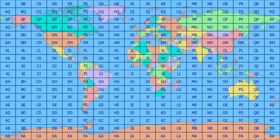
This map shows all of the 324 20° x 10° Major Grid Locator rectangles of the IARU Grid Locator system, overlaid on a World Map. Click on one of the rectangles to open a larger PNG map (approx 1980 x 990 px; 53.5 x 26.8 cm; 21.07 x 10.53 in) containing 3x3 Major Grid Locator rectangles, with all of their 900 minor 2° x 1° Grid Locator rectangles, and country-prefixes, in a new browser window.
If you would like to download ONE HUGE MAP, 11900 x 5950 Pixels; 321.6 x 160.8 cm; 126.60 x 63.30 in; with file-size: 12MB, click here. It looks great on a 4K UHD monitor.
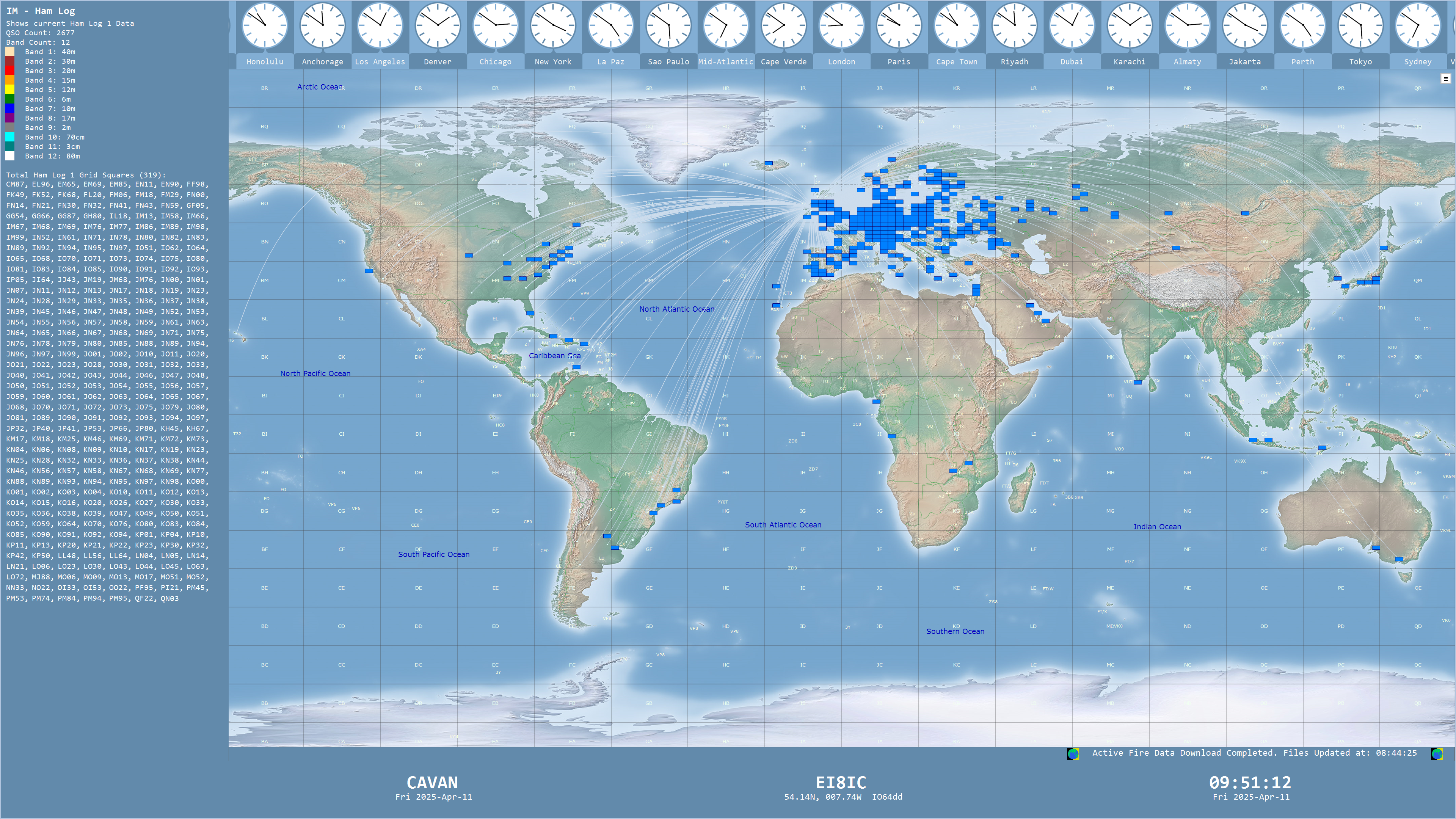
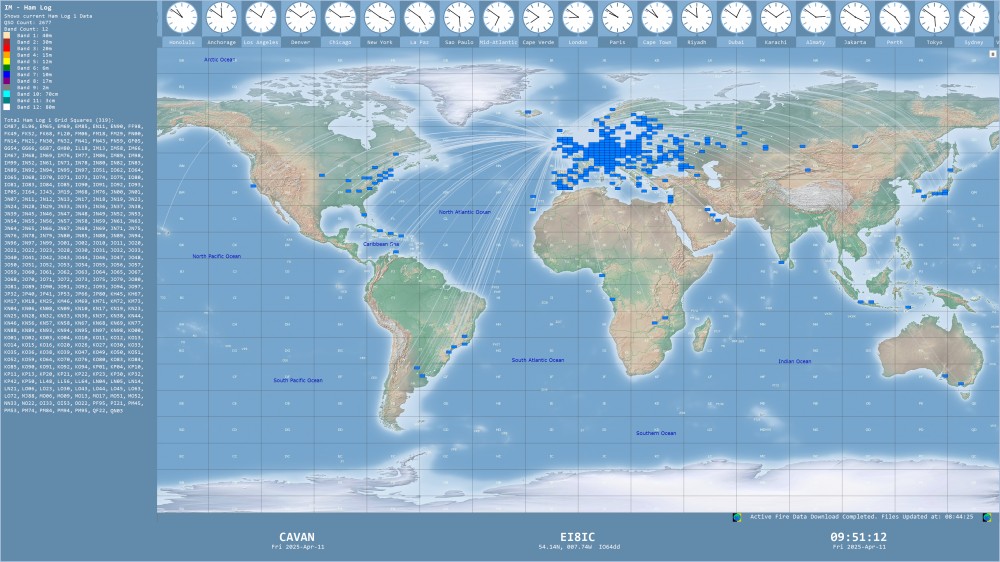
If you want to plot the Grid Locators in an ADIF log, try the 'Time Mapper UHD' program. Here is an example of it's Grid Locator plot. Click to see full size:
You are welcome to use these maps on your own NON-COMMERCIAL website, if you include a link to this site, and DO NOT edit them in any way. Please Contact Me for other uses, sizes, styles, formats, or projections.
If you use my maps, please buy me a coffee.
How much did you spend on your rigs and antennas? Buying me a coffee isn't much in comparison, is it?!
|